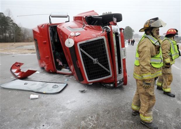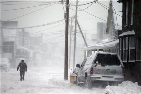

JACKSON, Mississippi (AP) — The Arctic blast that sent subfreezing temperatures, snow and sleet across Mississippi is being blamed for four deaths from a fire as well as hundreds of wrecks and road closures.
The four victims in the early Tuesday mobile home fire, blamed on a faulty gas space heater in the living room, ranged from 3 months to 30 years old, Itawamba County Sheriff Chris Dickinson said. At a news conference, Mississippi Emergency Management Agency Director Robert Latham blamed the cold weather for the deaths.
Dickinson didn’t identify the victims but said a total of nine people were in the mobile home at the time of the blaze and were using the heater for warmth.
Gov. Phil Bryant has decided to keep closed — at least until noon Wednesday — all state offices that were affected by winter weather, Latham said.
Latham also said 59 school districts were closed Tuesday, and 25 had already decided that classes would be out Wednesday. He said the number is going up, and others are considering starting classes later in the day.
Mississippi Highway Patrol Col. Donnell Berry said troopers had worked 200 wrecks blamed on the weather, which continued to deteriorate in south Mississippi with sleet and snow early Wednesday. Bridges to Bay St. Louis and Ocean Springs were closed.
Treacherous conditions stretched mainly from the Interstate 20 corridor to south Mississippi. The patrol urged motorists to stay at home or be prepared for hazardous conditions if they ventured out.
“Just a rule of thumb, if it’s south of I-20, it’s probably frozen,” said Willie Huff of the Mississippi Department of Transportation.
Members of the state’s House and Senate who had arrived before the onset of bad weather left the Capitol early Tuesday and were expected to return late Wednesday. Several committee meetings were held Tuesday, even as snow coated the Capitol grounds in downtown Jackson.
Areas south of the I-20 corridor saw the most snow accumulation Tuesday, Alan Campbell of the National Weather Service said.
While the precipitation stopped in some parts of central Mississippi, more was expected farther south.
Robert Ricks, forecaster with the National Weather Service in Slidell, La., said the freezing line was expected to hit the Gulf Coast and last until early Wednesday morning.
Ricks said South Mississippians should expect to see light rain before it transitions slowly to sleet and freezing rain as temperatures continue to drop.
“Once the rain starts, it looks like it will continue through daybreak (Wednesday) morning, about 5 a.m.,” he said. “It will convert over to a light snow sometime around midnight before it ends completely.
“It’ll be mostly freezing rain, which will freeze on surfaces, so bridges and overpasses get coated really easily with that during the afternoon and evening hours,” he added.
Ricks said by the time the storm has passed, south Mississippi could accumulate up to a quarter-inch of ice and possibly an inch of snow depending on when the precipitation switches over.
In central Mississippi, more than 2 inches of snow were recorded in Puckett Tuesday morning, while Florence had roughly 1.8 inches. Overall, the area should see snow between 1-2 inches, Campbell said.
He said temperatures aren’t expected to go rise above the freezing mark until Wednesday.


