
ATLANTA (AP) – The Latest on the threat of severe weather across the Southeast (all times local):
7:30 p.m.
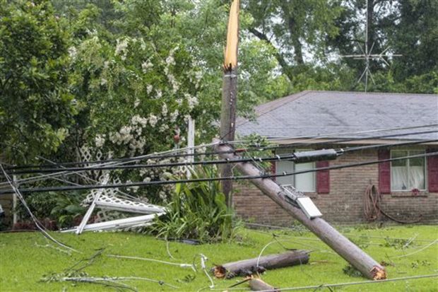
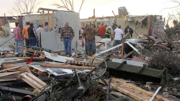
Severe storms have damaged buildings and downed trees in a northern Alabama county.
The Limestone County Sheriff’s Office posted photos on Twitter of houses without roofs and destroyed garages in Ardmore, Alabama, on Monday evening. But it had no reports of injuries from the storms.
The office also tweeted that downed trees and power lines were blocking roads in the county along the Tennessee border.
The National Weather Service in Huntsville, Alabama, issued a severe weather statement at 6:41 p.m. that a confirmed tornado was over Ardmore and moving east.
5:45 p.m.
The University of Alabama planned to suspend normal operations Monday evening because of a severe weather threat.
The school said in a news release that operations would be suspended from 6:30 p.m. until midnight. That means classes and campus activities scheduled during that window are canceled.
University libraries were set to close at 6:30 p.m. and some dining halls were set to close early.
Campus shelters were open to students, faculty and staff at North Campus Storm Shelter, East Campus Storm Shelter and the Magnolia Parking Deck. The Magnolia Parking Deck accepts pets accompanied by their owners.
The university plans to provide updates on Twitter at @UA_Safety.
4:35 p.m.
State officials are warning residents in northern Alabama to brace for severe weather Monday evening.
State meteorologist Jim Stefkovich said at an afternoon news conference that the “potential for strong to violent, long-track tornadoes is a real possibility.”
Stefkovich says storms moving into north Alabama will reach the Interstate 20 and Interstate 59 corridor between 7 and 10 p.m. and exit the state south of Interstate 85 and east of Interstate 65 between midnight and 2 a.m. Warnings could extend south to Dothan overnight.
Gov. Kay Ivey urged Alabama residents to implement safety plans and get in a safe location.
Alabama Emergency Management Executive Operations Officer Jeff Smitherman raised the threat level and increased staffing at Alabama’s emergency management agency. This is the first severe weather to hit the state this year.
4:15 p.m.
Forecasters say a late winter storm is expected to bring significant snowfall to parts of West Virginia this week.
The National Weather Service has issued a winter storm warning or watch for more than half of West Virginia’s 55 counties beginning early Tuesday. Snowfall in amounts of 6 inches (15 centimeters) or more are possible.
Some parts of the state are expected to receive a mix of rain, sleet and snow before changing to heavy, wet snow Tuesday night. The weather service says power outages could occur where the heaviest amounts fall.
3:55 p.m.
The National Weather Service has issued a tornado watch for parts of three Southeastern states and says the region faces a particularly dangerous situation.
The watch covers all of north Alabama including the cities of Birmingham and Huntsville, plus smaller areas in northeastern Mississippi and southern Tennessee. It expires at 11 p.m. CDT.
Forecasters say the storm threat is unusually dangerous because of the possibility of several tornadoes, some of which could be intense. The weather service says hail as large as 3 inches (7 centimeters) in diameter could fall, and there’s a possibility of wind gusts to 70 mph (110 kph).
Forecasters already have reported hail in Mississippi, and they issued a tornado warning for a section of northwestern Alabama.
Temperatures will turn cooler Tuesday after a cold front passes.
1:15 p.m.
A strong thunderstorm has begun dropping hail in northern Mississippi as the Southeast braces for a round of storms that threaten to bring strong tornadoes.
In Mississippi on Monday, the National Weather Service reports hail near Ripley, while radar indicates hail fell along a 50-mile (80-kilometer) path from Holly Springs to Booneville. The storm has tracked all the way across the state from west to east, decreasing in severity as it nears Alabama.
Pictures posted to social media showed as many as several inches of pea-sized hail in some places.
Twenty-nine million people face a threat of severe storms that could bring damaging hail, high wind and even tornadoes to the southeastern United States.
11:20 a.m.
Forecasters say there’s increasing confidence that strong tornadoes could rumble across parts of the South – especially northern Alabama.
In a midmorning update Monday, the national Storm Prediction Center said the risk appeared increasingly likely for “several tornadic supercells” to traverse northern parts of Alabama.
The region is in the bulls-eye of a larger area under threat of severe weather Monday afternoon that also included parts of Tennessee, Mississippi and Georgia.
Twenty-nine million people faced a threat of severe storms Monday that could bring damaging hail, high wind and even tornadoes to the southeastern United States.
8:20 a.m.
Schools are closing early in the southeastern United States because of the threat of severe weather including tornadoes.
More than a dozen school systems in northern Alabama announced they’re dismissing students early Monday because of a line of storms forecasters say will move through the area. Scattered early-closings extend into central Tennessee.
Other school systems say they’re monitoring conditions and could release students early if conditions warrant. Birmingham city offices are closing at noon because of the threat.
The National Weather Service says thunderstorms will develop ahead of an approaching storm system. They say tornadoes, damaging winds and hail as large as tennis balls are all possible.
7:15 a.m.
Twenty-nine million people faced a threat of severe storms Monday that could bring damaging hail, high wind and even tornadoes to the southeastern United States.
The national Storm Prediction Center said large parts of Alabama, Georgia and Tennessee and a small portion of northeast Mississippi would be under a tornado threat Monday afternoon and Monday evening. Forecasters said enhanced risk of severe storms covers Nashville and Chattanooga in Tennessee; and Birmingham, Huntsville and Tuscaloosa in Alabama.
In Alabama, tornadoes, hail the size of tennis balls and 70 mph (110 kph) winds were most likely to occur in parts of central and northern Alabama, including all of metro Birmingham.
In Georgia, the highest risk of tornadoes will be in northwest Georgia, including Dalton, Rome and Cartersville.


Be the first to comment